Arthur, this year’s first named Atlantic storm, still poses threats of severe flash flooding in Southeast

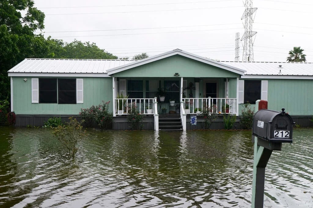
Water surrounds homes in the aftermath of Tropical Storm Arthur in rural Brazoria County, Texas, Wednesday, June 17, 2026. \ CBS
Arthur, a short-lived tropical storm and the first of this year’s Atlantic hurricane season, lost some punch Wednesday after making landfall along the Gulf Coast of Texas.
But it still has the potential to cause life-threatening flash flooding from Texas to Florida through the end of the week, the National Weather Service said, despite being downgraded to a post-tropical cyclone.
The system formed in the western Gulf of Mexico and reached tropical storm status on Wednesday morning near the middle of the Texas coast, less than 50 miles from Port O’Connor, according to the hurricane center. By late Wednesday night, Arthur’s maximum sustained wind speed had fallen to 35 mph, below the 39 mph threshold for classification as a named tropical storm.
Arthur’s remnants are expected to move farther inland over southeastern Texas and western Louisiana, “then cross the southeastern United States Thursday through Friday.”
“While additional weakening is expected as the system moves inland, the remnants of Arthur will continue to produce widespread heavy rains across the southeastern United States during the next few days,” the hurricane center said, with “life-threatening flooding” expected to continue in parts of the region.
Arthur started developing earlier this week as a tropical disturbance in the western Gulf of Mexico. It emerged and strengthened as coastal communities in the path of the storm contended with ongoing bouts of intense rain that triggered dangerous flash flooding in multiple states.
Arthur will likely dump 5 to 10 inches of rain on sections of Texas, Louisiana, Mississippi and Alabama, along with western portions of the Florida Panhandle through early Friday, the hurricane center said, adding, “This could generate dangerous to life-threatening flash flooding.”
The storm was also expected to produce “life-threatening surf and rip current conditions along the northwestern Gulf Coast for the next day or two,” the center said. Some tornadoes are possible, as well.
Atlantic hurricane season runs from June 1 to Nov. 30, although tropical storm and hurricane activity usually peaks between August and October. Forecasters predicted this season will bring fewer storms than an average year, with the National Oceanic and Atmospheric Administration’s latest outlook calling for eight to 14 named storms, of which three to five might grow into hurricanes.